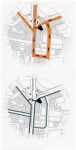
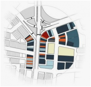
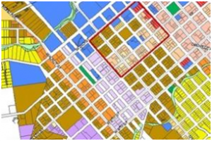
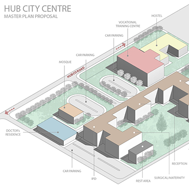
Categorizing land use and properties across a wide geographic area is a process known as zoning. This process seems to be an effective tool for urban planning and development. City maps demonstrate communities to be divided according to their respective uses – residential, commercial, industrial, recreational and public facilities. Division enables the authorities to keep track of land use and keep the compliance of the permit application in check.
Each zone tends to have its ordinance, controlling the development of that respective region. These laws affect the size and height of the projects being built, their shape and color, along with the location.
Due to the process of zoning, the government can look after the usage as well as the misuse of the land. It assists to regulate the changing environmental conditions – flooding and sea levels.
 Zones are established according to multiple factors; function, physical characteristics, the intensity of projects and the incentive behind the development.
Functional Zoning refers to dividing the land according to the purpose it serves; commercial, industrial or residential. If divided by this method, each allocated area is expected to show their respective regulations regarding the activities being conducted within the boundary.
Physical Zoning: Each district is then classified into smaller identities such as commercial, industrial and residential. These general categories can be segregated further; residential is divided into single-family homes per acre, low/high rise apartments and institutional housing. While the industrial zone can be categorized according to the intensity of work – heavy, light and research. It also depends on the amount of area occupied by the plant. On the other hand, within the commercial district, small shops, malls, theatres can be identified. Rural areas, agriculture-related sites, as well as historic buildings, can be identified as individual zones.
Zones can be defined in relevance to their urban identification. An area such as downtown could be identified which would allow the general population to relate to it easily and make them more geographically aware.
 Intensity zoning recognizes land usage and density constraints. It allows one to monitor already established projects along with the possibility of potential projects. As a result, the decision for development within that area is made carefully.
Certain plans are taken up to provide the inhabitants of the city with proper infrastructure. Builders are encouraged to take over such projects by providing them with an incentive; lower level of restrictions and tax rates. Projects can be categorized according to the incentive provided and as a result, a relevant zone can be established.
 The division results in the regulation of the buildings within that sector; the governing authority observes the character of the property concerning its environment and considers its fitness for the people; aiming to serve the general welfare. However, the regulations applied to each zone often limits the existence of public facilities such as parks, roads, and parking areas as well as controls the level of signage.
It is often observed that more than one type of zoning to be applied to an area. However, problems can arise due to the juxtaposition of multiple restrictions imposed due to the combination of different zones while maintaining the development forces.
Dividing the city into districts allows one to monitor what is happening within and therefore make better decisions regarding the growth of the city. It also provides one with information about what occurs in the surrounding areas as well as their status of stability.
References
Encyclopedia.com. (2019). Zoning | Encyclopedia.com. [online] [Accessed 31 Jul. 2019].
People.uwec.edu. (2019). WHAT IS ZONING. [online] [Accessed 31 Jul. 2019].
The Geography of Transport Systems. (2019). Types of Land Use Zoning. [online] [Accessed 31 Jul. 2019].
Zoning and urban planning Understanding the benefits. (2019). Doing Business 2015. [online] [Accessed 31 Jul. 2019].

